Workshop Summary
AESC 2014 WORKSHOP SUMMARY
All workshops will take place in Newcastle City Hall unless noted otherwise.
Presenters: Adj. A/Prof Paul Ashley, University of New England and Dr Nancy Vickery University of New England
No. of Days: 2 days
Date: Saturday 5 & Sunday 6 July
Time: 0900- 1700
Cost: $1400 p/p
Inclusions: Morning Tea, Lunch & Afternoon tea and course notes
Booking Deadline: Friday 30 May 2014
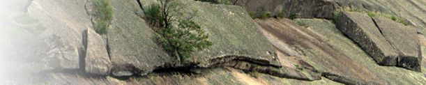
A 2-day workshop on the nature and causes of hydrothermal alteration and its association with a wide variety of different mineral deposit types. Lecture-type presentations will be accompanied by hands-on practical sessions. These will include examination of hand samples of rocks from ore deposit systems such as porphyry Cu-Au, intrusion-related Au and Mo systems, intrusion-related Sn, epithermal precious metal systems (including low and high sulphidation types), a diversity of skarn types, iron oxide-Cu-Au deposits, volcanic-associated massive sulphide systems, “Cobar-type” Au and base metal deposits, orogenic Au (-Sb) and sediment-hosted sulphide deposits, including shale-hosted, red-bed hosted and carbonate-hosted. Observations can be augmented by the use of petrographic microscopes with real time projector demonstrations. An infrared spectral analyser and portable XRF analyser will be available to demonstrate geochemical and mineralogical attributes of different alteration types.
Attendees are required to bring own laptops.
GEOLOGICAL INTERPRETATION OF AEROMAGNETIC DATA
Presenter: Mr Leigh Rankin, Rankin Consultancy Pty Ltd (trading as Geointerp)
No. of Days: 2 days
Date: Saturday 5 & Sunday 6 July
Time: 0900- 1700
Cost: $930 p/p
Inclusions: Morning Tea, Lunch & Afternoon tea and course notes
Booking Deadline: Friday 30 May 2014
This workshop is designed to develop skills in the integration of aeromagnetic and geological data, particularly in the exploration environment. It is suitable for all geoscientists involved with field mapping and exploration. Two exercises from different geological settings (Pine Creek Geosyncline and Charters Towers areas) will demonstrate a reliable methodology for interpretation and analysis, and will be interspersed with presentations on key issues of the physical and geological aspects of magnetisation, processing and imaging of magnetic data and interpretation methodology.
Whilst the exercises in this workshop focus on two gold exploration districts, the methodology presented will have application to most geological environments.
All materials will be provided (exercises are hand drawn) – computers will not be required.
REGIONAL GEOCHEMICAL MAPPING – PRINCIPLES & PRACTICALITIES
Presenter: A/Prof David Cohen, University of NSW and Dr Patrice de Caritat, Geoscience Australia
No. of Days: 1 day
Date: Sunday 6 July
Time: 0900 - 1700
Cost: $370 p/p
Inclusions: Morning Tea, Lunch & Afternoon tea and course notes
Booking Deadline: Friday 30 May 2014
Geochemical mapping programs have been conducted in many parts of the world, at sampling densities as low as 1 sample per 5,000 km2.
Originally directed at mineral exploration, in post-mining and industrialised areas geochemical mapping is now primarily used for environmental, health and agricultural purposes. Even at low sampling densities, regional geochemical maps can provide fascinating insights into processes affecting the geochemical characteristics of regolith (soils and sediments) and permit separation of natural and anthropogenic factors affecting the distribution of elements.
This workshop will cover various aspects of regional geochemical mapping (and some general aspects of geochemistry) – from sampling design and analytical options to data processing approaches. A number of case studies will be presented, including data derived from the recently completed geochemical atlases of Australia and Cyprus. It is a workshop and participants will have opportunity to undertake various exercises ranging from analytical data quality to interpretation of regional geochemical patterns.
NB Participants are required to bring their own laptops.
TECHNOLOGY TO IMPROVE GOLD EXPLORATION AND ORE CHARACTERISATION
Presenter: Prof Ross Large, UTAS Distinguished Professor, Professor of Economic Geology, CODES
No. of Days: 1 day
Date: Sunday 6 July
Time: 0900 - 1700
Cost: $400 p/p
Inclusions: Morning Tea, Lunch & Afternoon tea and course notes
Booking Deadline: Friday 30 May 2014
The workshop will cover advances in laser analytical techniques that have led to the development of new exploration strategies for orogenic, sediment-hosted and Carlin style gold deposits. Several case studies will be discussed covering geology, geochemistry, ore genesis and gold ore characterisation.
ESTABLISHING AND DEFINING STRATIGRAPHIC UNITS
Presenter: Ms Catherine Brown, Geoscience Australia
No. of Days: ½ day
Date: Friday 11 July
Time: 0930 - 1200
Cost: $100 p/p
Inclusions: Morning Tea and course notes
Booking Deadline: Friday 30 May 2014
The Workshop aims to encourage more of Australia’s geologists to define and/or redefine stratigraphic units, through discussion of Australian examples and issues.
We hope to:
• Demystify the fundamental concepts such as what is lithostratigraphy? Why are definitions important? What is a type section? What procedures apply in Australia? How do I pick a suitable name?
• Provide advice on locating important resources such as the Australian Stratigraphic Units Database, the International Stratigraphic Guide, the Australian Stratigraphy web pages and unit definition form, members of the Australian Stratigraphy Commission, and the current International Time Scale.
• Use Australian examples to show how the International Stratigraphic Guide has been interpreted in Australia. This will include discussion on ways of dealing with various lithologies, mixed lithologies, and particular issues with igneous units; what to do with ‘legacy units’ that don’t meet the current guidelines; why units are split up or grouped together; and any other stratigraphic issues participants wish to raise.
• Explain how data from your publications gets into the Australia Stratigraphic Units Database and offer ideas on streamlining your writing and refereeing processes to get high quality new unit definitions approved and published in a timely manner.
Presenter: Dr Bill Laing, Laing Exploration
No. of Days: 1 day
Date: Friday 11 July
Time: 0830 – 1730 (Minibus departs City Hall 0730)
Cost: $600 p/p
Location: Catherine Hill Bay Surf Club
Inclusions: Morning Tea, Lunch & Afternoon tea, transfers to/from Catherine Hill Bay & course manual
Booking Deadline: Friday 30 May 2014
Smart Mapping is a new paradigm of geological mapping. Smart Mapping is founded on the scientific working hypothesis, and its driving of our decisions every moment of the mapping process. Smart Mapping does not do what University mapping courses do, and it does what they do not. It is for practising (1-50 year) geologists, who wish to transform their mapping from a unidimensional, “area-covering” procedure into a multi-dimensional, “hypothesis-covering” outcome. From a spreader of geology onto a map sandwich, you will become an instinctive finder of geological reality, and a proactive manager of your mapping time, money and output, driven by decision points. The best Smart Mappers are lazy, poor bushwalkers, miss lots of outcrops, know not where they will be at the end of the day, and revel in their work. The Course draws on mentors -“older and wiser” participants - to grow the group’s mapping wisdom. Smart Mappers are better mappers and better interpreters of maps. Smart Mappers become invaluable to their employer.
Smart Mapping recognises the highly variable information fertility of geological exposures, deriving from the two different categories of geological data: spatial data (low fertility) and boundary condition data (high fertility). Identifying maximum fertility sites (MFS) is a key initial tool which shapes and short-circuits the whole subsequent mapping strategy, from design of the first entry into “the area” to the final mapping products. Mapping becomes the question “Why should I stop at this outcrop?” and you know the answer before you get there. Other key tools are geotopographic sites, geological bonsais, architectural templates, and knowing how to drive your mapping computer.
Smart Mapping platforms all mapping environments: regional, prospect, minesite, drillcore, and special-purpose mapping such as helicopter reconnaissance. Smart Mapping has special strategies for data-poor and data-rich environments. It employs a 200 page Manual, and includes desktop exercises and an onsite exercise at Catherine Hill Bay.
INTERPRETATION OF HYLOGGER DATA TO EXPLORATION & MINING
Presenter: Dr Sasha Pontual, AusSpec International
No. of Days: 1 day
Date: Friday 11 July
Time: 0900 – 1700
Cost: $715 p/p
Inclusions: Morning Tea, Lunch & Afternoon Tea, course notes & USB containing data discussed during workshop
Booking Deadline: Friday 30 May 2014
A hands-on workshop on how to interpret HyLogger data and to best identify alteration assemblages to assist targeting of economic mineralisation. The workshop will introduce participants to the theory behind hyperspectral analysis to provide a strong background and understanding of the relevance of infrared data to alteration mapping. Using case study data sets, the workshop will also introduce participants to some key features of The Spectral Geologist (TSG) software for interpreting and manipulating hyperspectral data collected by the HyLogger systems. Participants will learn methods of extracting mineral information from VNIR-SWIR-TIR reflectance data and how to integrate these data with assay and logging data.
NB: Participants are required to bring their own laptops
COAL QUALITY ASSESSMENT FOR GEOLOGICAL PURPOSES
Presenter: Prof Colin Ward, University of NSW
No. of Days: 1 day
Date: Friday 11 July
Time: 0900 – 1700
Cost: $435 p/p
Inclusions: Morning Tea, Lunch & Afternoon Tea & course notes
Booking Deadline: Friday 30 May 2014
This one-day course is intended for geoscientists newly engaged or seeking involvement in coal exploration and mining activities. The program aims to increase participants’ awareness of the physical, chemical and petrographic properties of coal, the geological factors affecting coal sampling and analysis results, the significance of quality parameters in coal utilisation and marketing, and geological considerations in obtaining and dealing with coal quality data.
1. General Introduction
• Fundamental concepts of coal rank, type and grade.
• Relevant Standards and other information sources.
2. Coal Testing and Analysis
• Coal sampling and sample preparation
• Proximate and ultimate analysis
• Other general tests and analyses
• Special tests for coal combustion
• Coal carbonization and coking tests
• Assessment of gas in coal seams
3. Coal Petrology and Petrographic Analysis
• Microscope techniques used in coal petrology
• Microscope coal constituents: macerals and microlithotypes
• Coal lithotypes and megascopic (hand specimen) seam description
• Nature, analysis and significance of mineral matter in coal
4. Quality Assessment in Exploration and Mine Geology Programs
• Sampling and analysis strategies
• Selection of working sections; allowance for dilution
• Calculation of quality parameters for ply and seam composites
SALT LAKE POTASH RESOURCES – FROM EXPLORATION TO DEVELOPMENT
Presenter: Adj. Prof Aharon Arakel, Macquarie University
No. of Days: 1 day
Date: Sunday 6 July
Time: 0900 – 1700
Cost: $200 p/p
Inclusions: Morning Tea, Lunch & Afternoon Tea & course notes
Location: Crowne Plaza Newcastle
Booking Deadline: Friday 30 May 2014
Salt lakes are a ubiquotous feature of Australia’s landscape and their hydrological evolution closely linked with a major phase of arid-zone internal drainage basin development in Australia, dating back to Tertiary times. Historical and scientific information point to elevated concentrations of potassium and other valuable dissolved elements in the brine pools of many Australian salt lake basins. However, there is currently no established salt lake potash mining operation in Australia and until recently no systematic exploration effort was directed towards assessing the potash recovery potential of the Australian salt lakes. This is despite the fact that Australia has more than double the number of salt lakes as the rest of the world combined, and its strategic location with respect to SE Asian and Chinese fertiliser markets.
This one-day course is intended for geoscientists seeking involvement in salt lake potash exploration and mining activities. It aims at providing first-hand information on the approaches and scientific methods applied to systematic evaluation of mineral brine fields and techno-economic aspects of potash recovery from salt lake basins as a strategic resource. Topics to be covered:
General Introduction
- Overview of global activities and market attractiveness
- Fundamentals of salt lake exploration for strategic resources
Salt Lake Exploration Approaches
- Exploration models
- Resource development models
Hydrogeological Investigations
- Geophysical signatures
- Geologic controls
- Hydrogeologic setting
Drainage Basin Hydrological Evaluations
- Drilling
- Pump tests
- Field evaporation trials
- Hydrological modelling
Delineation of Mineral Brine Pools
- Palaeodrainage characteristics
- Host sediments and regolith cover
- Physical barriers
- Chemical barriers
Exploration, Planning and Implementation
- Exploration trategy
- Definition of exploration targets
- Planning and implementation
Brine Quality and Resource Evaluations
- Brine types
- Brine analysis and statistical analysis
- Laboratory isothermal evaporation trials
- Geochemical modelling
- Resource estimation methods
Product Streams and Mining Methods
- Evaporation, mineralisation and separation trials
- Integrated brine processing and mineral recovery
Techno-Economic Evaluations
- Scoping study
- Pre-feasibility study
- Definitive feasibility study
THE GLOBAL MULTIPLE SULPHUR ISOTOPE RECORD: INSIGHTS INTO THE EVOLUTION OF THE EARLY EARTH AND GENESIS OF MINERAL SYSTEMS
Presenter: Prof Marco Fiorentini, University of Western Australia
No. of Days: 1 day
Date: Friday 11 July
Time: 0900 – 1700
Cost: $250 p/p
Inclusions: Morning Tea, Lunch & Afternoon Tea & course notes
Booking Deadline: Friday 30 May 2014
Sulfur (S) is a crucial element that is involved in numerous biological processes and is a critical ligand that complexes, transports and concentrates a wide range of metals in hydrothermal fluids and silicate melts. As a result, sulfides play a key role in the formation of numerous world-class mineral systems, including gold, nickel, copper and the platinum group elements.
However, even if the scientific community broadly agrees that sulfur most likely played a crucial role in the establishment of the first forms of proto-life, the relationship between the global sulfur cycle and the evolution of the biosphere-atmosphere-hydrosphere-lithosphere in the Early Earth is still a hot topic of debate. Furthermore, although the genetic association between sulfur and metal enrichment is well established, it is generally difficult to fingerprint and spatially localize the sulfur and metal sources that play a role in ore genesis.
This workshop aims at bringing together the sulfur isotope community to present the latest advances in our understanding of the multiple sulfur isotope signature record and jointly identify the greatest knowledge gaps that should be addressed in the short term future. In particular, the main topic of debate will be focused on the processes that lead to the genesis and preservation of mass independent sulfur isotope signatures in the global geological record. In fact, in the last two decades, the discovery and measurement of non-mass dependent sulfur isotope signatures in sedimentary, igneous and metamorphic rocks has permitted the formulation of numerous new hypotheses on the evolution of the Early Earth. The analytical techniques, both for whole-rock and in-situ analysis of a wide range of S-bearing phases, including sulfides, sulfates and phosphates, have dramatically improved and it is now possible to measure precisely and accurately extremely faint isotopic signals. However, our capacity to generate data has overcome our ability to interpret them.
REMOTE SENSING AND FIELD SPECTROSCOPY FOR GEOSCIENTISTS
Presenter: Dr Rob Hewson, Royal Melbourne Institute of Technology
No. of Days: 1 day
Date: Saturday 12 July
Time: 0900 – 1700
Cost: $570 p/p
Inclusions: Morning Tea, Lunch & Afternoon Tea & course notes
Booking Deadline: Friday 30 May 2014
A one day workshop on the background of remote sensing and mineral spectroscopy relevant for geological and regolith investigations. Lecture-type presentations will be accompanied by hands-on practical sessions accessing remote sensing imagery, derived map products and mineral spectral signatures. Geological case studies, with a focus on mineral exploration, will be examined using ASTER multispectral satellite, airborne hyperspectral imagery and field spectrometer data sets. Issues covered include costings, sensor resolution, atmospheric interference, illumination conditions, vegetation cover and other quality control aspects. Examples of strategies to integrate such datasets with geophysical data (e.g. aeromagnetics, radiometrics), DEMs and public domain fractional cover estimates (e.g. vegetation cover %). A detailed examination of current (and future) airborne / satellite sensors and field spectrometers will be described.
The resulting take home information will provide an overview of various operational remote sensing and field data sets, to enable the participant to assess its viability for specific geoscientific questions. The ultimate aim is to empower the participant with the knowledge to initially undertake or contract out spectral investigations as part of mineral exploration.
Participants are required to bring their own laptops.